Introduction
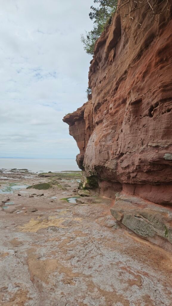
Lets Experience the World’s Highest Tides at Burntcoat Head Park. Burntcoat Head Park is home of the World`s Highest Record Tides. 100 billion tones of water flow into the basin every 6 hours and 13 minutes, surpassing the combined flow of all the world’s freshwater rivers. In 1975 the Guinness Book of World records asserted that Burntcoat Head had the “worlds greatest mean spring range” To fully appreciate the breathtaking power of the Burntcoat, make sure to visit during both low and high tide.

What Science Says
Why do the ocean tides move up and down each day? Ocean tides are affected by the gravity of the moon and its position relative to the earth. As the earth rotates, the moon’s place in the sky changes, too. For example: when the moon is overhead or at the far side of the earth, we have high tides. But when the moon is a quarter away in either direction, the tide is low. The moon passes over a different quarter of the earth every 6 hours and 13 minutes, and the ocean level rises and falls following that moon. The moon’s gravity also affects our atmosphere and ground, but we can actually see and feel its impact only on the ocean.

Spring and Neap Tides The sun’s gravity also affects the ocean. Twice a month, during the full moon and the new moon, the earth, moon and sun are all in a line. The combined gravity of the sun and moon makes the ocean tides rise even higher than normal. This is known as a “spring tide”. When the moon is at first or third quarter the sun’s gravity partially cancels out the moon’s gravity and we have “neap tides”. The tidal range is at its minimum then.
A Different Kind of Water Tower Roughly every 6 hours and 13 minutes, 100 cubic kilometers of water enter or leave the Bay of Fundy. That’s more water than the combined daily flow of the world’s freshwater rivers. Imagine a cube of that size: 100km wide by 100km high by 100km deep.

Measuring a Record Long ago, the tidal range was measured simply by marking the pile of a pier when the water was at different levels. Of course, it’s not just a vertical distance: as the tide goes out, the bay recedes to the lowest point of land, sometimes hundreds of meters away from shore. In 1975 the Guinness Book of World Records asserted that Burntcoat Head had the “world’s greatest mean spring range”. Today, we have electronic methods of measuring water. In 1998, hydrographer’s confirmed the 1975 record by placing water level recorders on the bottom of the Bay of Fundy off Burntcoat Head. The device measured the pressure of the column of water above, and combined with measurements of salinity and temperature, measured water levels to give a precise tidal range to within centimeters – a 16.3 meter range, the highest ever recorded in the world.

Make Sure to Check the Tide Schedule before visiting the Park
Burntcoat Lighthouse

For over 150 years, lighthouses at Burntcoat Head have guided sailors and fishermen safely home. The first lighthouse, built in 1858 and lit in 1859, was a 50-foot wooden tower with kerosene lamps visible for 13 miles. Originally connected to the mainland by a narrow neck of land, erosion eventually isolated the lighthouse, requiring a ladder to reach it. In 1913, the original structure was demolished, and some of its wood was used to build the new lighthouse.
The second lighthouse at Burntcoat Head was a 39-foot square wooden dwelling with an octagonal iron lantern, emitting a light visible for 14 miles. In 1972, it was burned down and replaced by a 22-foot skeleton mast, which was later discontinued, leaving no navigation marker.
Determined to restore the lighthouse, citizens obtained plans from the Coast Guard in July 1994, and by November, a replica was nearly complete. The Municipality of East Hants and seasonal park staff have since enhanced the lighthouse with pine boards and additional furnishings, creating a warm atmosphere and better display space for local crafts.
SEE THE LIVE VIEW OF BURNTCOAT HEAD HERE
Address: 45 Faulkner Ln, Noel, NS B0N 2C0
Phone: (902) 369-2529
